
🌦️ Climate of Jharkhand: Comprehensive Masterclass Notes (JPSC 2026)
1. Introduction & Environmental Baseline
The atmospheric dynamics of Jharkhand represent one of the most fascinating micro-climatic zones in Eastern India. Situated over the elevated, mineral-rich Chota Nagpur Plateau, the state experiences a unique blend of intense tropical solar radiation and elevation-cooled plateau air.
Understanding this climate system isn’t just about memorizing temperature numbers—it is about mastering how latitude, altitude, sea proximity, and monsoon troughs interact to dictate crop yields, forest cover (~29.81%), groundwater recharge, and seasonal weather extreme hazards like lightning strikes (वज्रपात).
2. Weather vs. Climate: Fundamental Definitions
A very common conceptual error in competitive examinations is confusing short-term weather fluctuations with long-term climate systems:
- Weather (मौसम): Refers to short-term, temporary conditions of the atmosphere occurring in the Troposphere (क्षोभ मंडल). It changes rapidly hour-by-hour (like a T20 cricket match where momentum swings every over).
- Climate (जलवायु): Defined by the World Meteorological Organization (WMO) as the long-term statistical pattern of weather parameters evaluated over a minimum period of 30 to 35 years (like a long Test Series average).
3. Regional Climate Metrics & Data Comparison
| Region | Key Geographic Feature | Temp Range | Average Rainfall |
|---|---|---|---|
| Palamu & Garhwa | Continental, severe heat waves & Loo | 25°C – 45°C | < 1200 mm (Drought Prone) |
| Netarhat (Pat Region) | Highest altitude (~1180m), coolest region | 4°C – 30°C | > 1800 mm (Highest) |
| Chaibasa Plain | Rain Shadow Zone (वृष्टि छाया क्षेत्र) | 18°C – 38°C | ~1000 mm (Lowest) |
| East Singhbhum | Bay of Bengal Maritime Proximity | 15°C – 40°C | 1400 – 1600 mm |
| Ranchi & Hazaribagh | Acute & Pleasant Type (~760m elevation) | 10°C – 35°C | 1300 – 1400 mm |
4. Geographical Factors Governing Climate
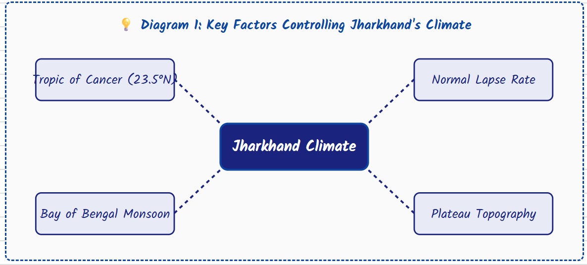
Four main physical parameters control Jharkhand’s weather system:
- Tropic of Cancer (23.5° N Latitude): Passes through the geographical center of the state across 6 districts:1. Latehar (Netarhat), 2. Lohardaga, 3. Ranchi (Kanke), 4. Ramgarh, 5. Bokaro, and 6. Dhanbad.
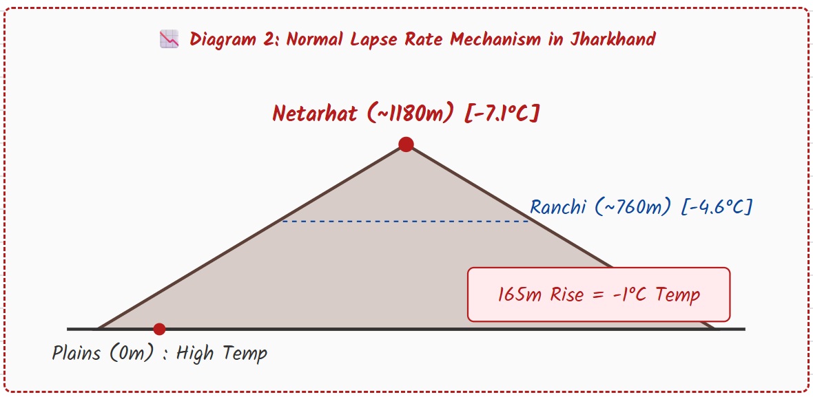
- Normal Lapse Rate & Altitude Effect: Atmospheric physics dictates that temperature decreases as altitude increases:Temperature drops by 1°C for every 165 meters of elevation gain.
- Continentality vs. Maritime Proximity: Southeastern regions benefit from Bay of Bengal air currents, while northwestern areas (Palamu) experience harsh heat waves (Loo) during summer.
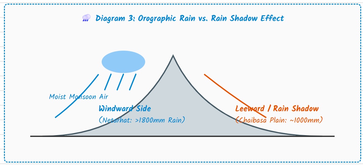
- Orographic Rainfall & Rain Shadows: Moist winds hitting the Netarhat or Rajmahal hills cool and condense into heavy rain. Descending winds on the leeward side leave Chaibasa Plain comparatively dry.
5. Climate Classification Systems
A. Köppen’s Scheme:
• Aw (Tropical Savanna Climate): Southern Jharkhand (Ranchi, Singhbhum) — high summer heat with dry winters.
• Cwg (Gangetic Moist Subtropical Climate): Northern Jharkhand (Palamu, Garhwa, Koderma) — influenced by Gangetic plain dynamics.
B. Dr. Ayodhya Prasad’s 7 Sub-Zones:
1. Continental Type: Palamu, Garhwa, Chatra
2. Sub-Continental Type: Hazaribagh, Giridih, Dhanbad
3. Delta Type: Sahibganj, Pakur (Bengal humidity influence)
4. Maritime Type: East & West Singhbhum, Saraikela
5. Moist / Rainy Type: Simdega, Western Ranchi
6. Acute & Pleasant Type: Ranchi and Hazaribagh plateau
7. Cold & Heavy Rainfall Type: Netarhat Pat Region
6. Seasonal Dynamics & Precipitation
- Southwest Monsoon: Accounts for approximately 80% of total annual rainfall. Intense May heat in Palamu creates a low-pressure trough that acts like a vacuum pulling moist Bay of Bengal air inland.
- Pre-Monsoon Nor’westers: Occur during summer in eastern districts (Santhal Pargana), locally referred to as Kal Baisakhi or Amra Bauchhar, benefiting mango and regional fruit crops.
- Western Disturbances (पश्चिमी विक्षोभ): Mediterranean temperate cyclones carried across Asia by the Subtropical Westerly Jet Stream (9–12 km altitude) bring light winter rain to Palamu and Chatra, highly beneficial for Rabi crops (wheat, mustard, gram).
📊 Economic Note (WPI vs CPI):
• WPI (Wholesale Price Index): Tracks wholesale production input costs.
• CPI (Consumer Price Index): Tracks retail consumer basket costs (Food carries ~45.86% weight).
Base Year Shift: Updating base year weights (2011-12 to 2024 series) aligns localized agricultural shocks (e.g., monsoon droughts) much faster with inflation tracking metrics.
7. Climate Risks & Environmental Policy
1. Lightning Mechanics (वज्रपात): Intense ground heating causes violent vertical convection, generating tall Cumulonimbus clouds. Friction between ice particles at freezing cloud heights generates static charge leading to strikes.
• Mitigation: Jharkhand utilizes the Sajag App to issue early satellite warnings 45 minutes prior to lightning strikes.
2. Pacific Oscillations (El Niño vs. La Niña):
• El Niño: Pacific warming disrupts atmospheric pressure, weakening monsoon winds and causing droughts (e.g., 226 blocks declared drought-hit in 2022).
• La Niña: Pacific cooling strengthens monsoons, causing heavy rainfall.
3. Just Transition: Under the Jharkhand State Action Plan on Climate Change (JSAPCC), the state is preparing for a “Just Transition”—phasing down coal dependence while retraining labor forces toward green energy and sustainable agriculture.
• Average Annual Rainfall: 1200 mm – 1400 mm
• Highest Rainfall Spot: Netarhat (> 1800 mm)
• Lowest Rainfall Spot: Chaibasa Plain
• Coldest Spot: Netarhat (Dips to 2°C – 4°C)
• Agro-Climatic Zones: 3 Main Sub-Zones (Sub-Zone IV, V, VI under Region 7)
• Forest Cover (ISFR): ~29.81%
8. Frequently Asked Questions (FAQs)
Q1: What is the overall climate type of Jharkhand?
Ans: Primarily a Tropical Monsoon Climate, with local sub-types ranging from continental in the north to pleasant plateau in Ranchi and cold/rainy in Netarhat.
Q2: Why is Chaibasa the driest region in Jharkhand?
Ans: Chaibasa sits in the rain shadow zone (वृष्टि छाया क्षेत्र) of the Kolhan hills, where descending winds lose moisture content.
Q3: How many districts are crossed by the Tropic of Cancer?
Ans: 6 districts: Latehar, Lohardaga, Ranchi, Ramgarh, Bokaro, and Dhanbad.